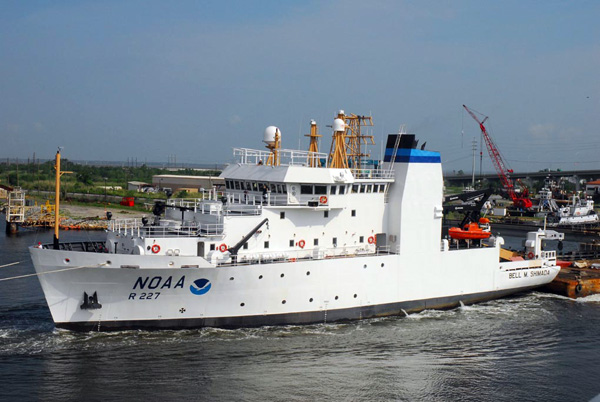
In March 2015, a team of NOAA-led researchers will explore the deep seafloor environment of the Channel Islands National Marine Sanctuary (CINMS). Data collected during this cruise will help supply ocean resource managers with the tools needed to preserve this amazing place. Timely data such as that collected during this cruise will shine a light on how these ecosystems are impacted by a variety of stresses facing them such as ocean acidification (OA). Using a remotely operated vehicle (ROV), a team of NOAA scientists will study the condition of deep-sea Lophelia pertusa corals in this area and monitor water chemistry in and around reefs to assess this ecosystem’s vulnerability to OA. The team will also document previously unmapped areas of the Sanctuary’s deep seafloor.
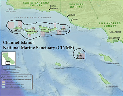
Channel Islands National Marine Sanctuary (CINMS), located off the coast of Santa Barbara and Ventura counties in California, is one of 14 federally designated marine protected areas administered by NOAA. The sanctuary encompasses 1,470 square miles of water offshore of Santa Barbara, Anacapa, Santa Cruz, Santa Rosa, and San Miguel islands, and is a special place for sensitive habitats. Also, the high acidity and high inorganic carbon of the California Current ecosystem make this location a natural laboratory to study the effects of OA on deep-sea organisms. Insights gained from the cruise surveys and collections will provide new information about the extent of deep-sea coral in the region and a baseline for possible climate change impacts to coral both within CINMS and worldwide.
 Ocean Acidification
When the ocean absorbs carbon dioxide (CO2), chemical reactions occur that reduce seawater pH and the amounts of available calcium carbonate minerals – this is known as ocean acidification (OA). Calcium carbonate minerals are the building blocks for the skeletons and shells of many marine organisms, including deep-sea corals. 2014 survey results indicate that corals in CINMS are already experiencing effects from OA, and waters in this area are projected to become even more acidic. These corals support extensive fish and invertebrate ecosystems, including commercially fished species, so it is important to monitor the potentially harmful effects OA has on this species. The OA team will collect samples of Lophelia pertusa, a stony reef-building deep-sea coral found in CINMS, as well as water samples using a CTD-niskin rosette, to help measure local effects of climate change.
Technology
Cruise researchers will employ a couple of different advanced technologies to get their jobs done including both multibeam sonar and the use of the Beagle ROV from Marine Applied Research and Exploration. This ROV is equipped with a high-definition video camera and multifunction manipulator arm to deploy data loggers and collect live corals to a depth of 500 meters. The ROV surveys will allow the research team to characterize unexplored habitat, as well as to assess abundance and condition of corals.
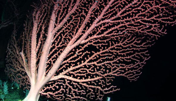
Bubblegum Coral. Credit:NOAA/MBARI 2006
Seafloor Mapping
The project’s seafloor mapping team will use sonar technology to explore areas of the Sanctuary that have not yet been mapped. Over 50% of the seafloor here has not been surveyed since the 1930s, when technology was must less sophisticated. These mapping efforts will extend NOAA’s mapping capabilities on the west coast. The team will also map areas at night to help guide the following
day’s ROV deployment. Sonars used for this mapping mission will describe the seafloor terrain in terms of coral and fish habitat, helping to guide research and marine resource management. The seafloor mapping team will also work to verify that the onboard ship systems are properly integrated with the sonars to improve data quality.
Expedition team
Participating institutions for this project include NOAA’s National Ocean Service (NOS) – Office of National Marine Sanctuaries, National Centers for Coastal Ocean Science, and Office of Coast Survey; National Marine Fisheries Service (NMFS) Deep Sea Coral Research and Technology Program; OAR – Ocean Exploration and Research; Marine Applied Research and Education; Oxnard Unified School District; and Claremont College.
Team leads are Dr. Chris Caldow, NOAA CINMS, expedition lead; Dr. Peter Etnoyer, deep-sea coral team lead; Dr. Laura Kracker, mapping team lead; Dr. Branwen Williams, Keck Science Department at Claremont College; and Sarah Raskin, Teacher at Sea. For more information on OA and deep-sea corals, please visit http://oceanacidification.noaa.gov and http://coralreef.noaa.gov/deepseacorals. To learn more about ocean exploration please visit http://oceanexplorer.noaa.gov.